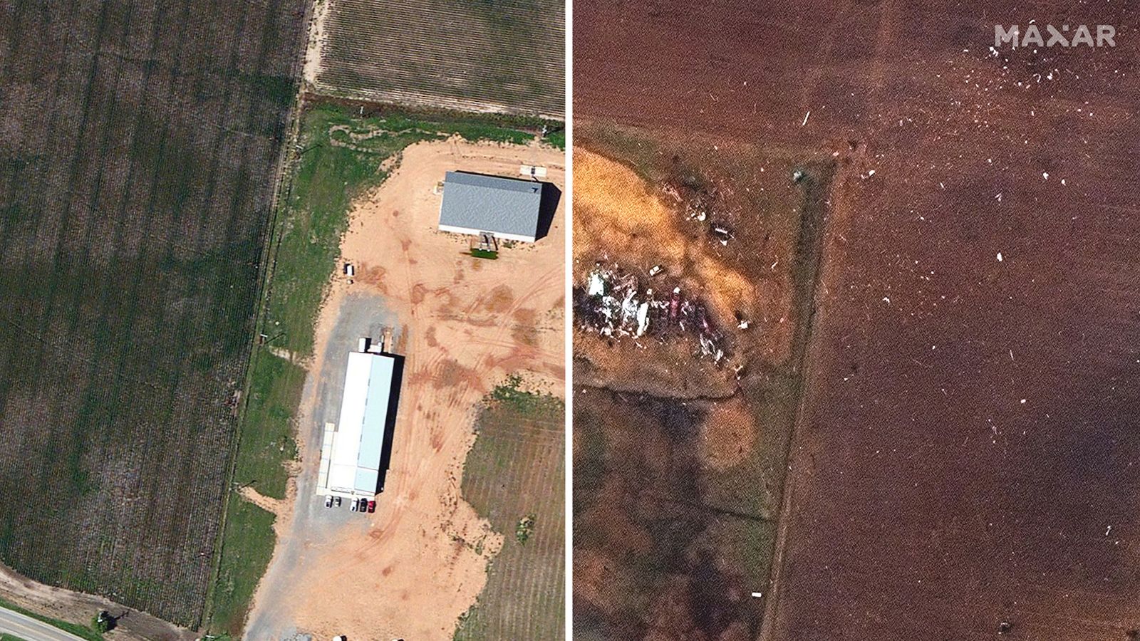
Beyond the human toll, the outbreak was exceptional for several meteorological reasons.
First, there is little precedent for the path length of the quad-state tornadic storm, which carved a 250-mile course through northeast Arkansas, southeast Missouri, northwest Tennessee and western Kentucky. The storm exhibited evidence of rotation even longer, for about 11 hours and 600 miles, according to Jack Sillin, a meteorology student at Cornell University:
While it is still not clear whether the storm spawned just a single tornado or several twisters, a rotating storm of that duration is very unusual any time of year.
The tornadic storm was extreme not only for its duration but also for its intensity. Evan Bentley, a tornado specialist at the National Weather Service Storm Prediction Center, tweeted that radar data would indicate it unleashed winds of 190 to 205 mph, suggesting it would rate as an EF4 or top-tier EF5 on the 0-to-5 Enhanced Fujita scale for tornado intensity. Meteorologists at the Weather Service are surveying the storm damage to assign an exact rating; the process could take a few days.
If the storm rates as an EF5, it would join only two other December tornadoes this strong.
Bentley also tweeted that the tornadic storm was rotating at an average speed of 94 mph for four hours, while noting that published research shows “only 1.5% of all tornadoes” spin at such speeds.
Radar data also revealed that the storm lofted debris for more than three hours, which is practically unheard of. Sometimes, radar detected debris above 30,000 feet, an incredibly rare occurrence. There have been numerous reports of items hurled by the storm found more than 100 miles away.
Only a highly anomalous storm environment could support such an extreme situation. Often, in December, the amount of fuel available to storms is limited, which is why violent tornado outbreaks aren’t more common. But on Friday, temperatures over the zone where the storm erupted were record-setting. The high temperatures, 20 to 30 degrees above normal, fast-forwarded the atmosphere to conditions more typical of April.
Many other atmospheric intricacies also contributed to the severity of the event, but it would not have been possible without the record-setting warmth.
As temperatures warm because of human-induced climate change during winter, it might mean the odds of such events increase in the future.
A modeling study published in the journal Earth’s Future last month concluded that environments conducive to thunderstorms will increase 5 to 20 percent for every 1.8 degrees of temperature increase, “with higher latitudes, particularly in the Northern Hemisphere, showing much larger relative changes.”
https://www.washingtonpost.com/weather/2021/12/12/december-tornadoes-quad-state-outbreak/


